| |||||
| Capital | Bereket | ||||
| Largest city | Bereket | ||||
| Other cities | Daşoguz, Cheleken Penisular Industrial City (built 2012 to 2015), Nebitdag, Gyzylarbat, Gumdag, Hazar, Etre, Esenguly, Gubadag, Konye-Urgench, Görogly and Mangʻit. | ||||
| Language official |
Turkmen and Russian | ||||
| others | Uzbek, Karakalpaka, Kyrgyz, Tajik, Afghan, Central Asian Arabic, Russian, Bukhori, Farsi and Russian | ||||
| Religion main |
Sunni Islam (de facto) | ||||
| others | Sufi Islam, Shia Islam, Judaism, Russian Orthodox and athist | ||||
| Ethnic Groups main |
Turkmen 92.5%, Russian 4.5% and Uzbek 3% | ||||
| others | Karakalpaka, Kurds, Tartars, Turks, Persian, Kyrgyz, Tajik, Afghan, Azeri, Kazakhs, Ukranians, Belorussians and Jews | ||||
| Demonym | Bati Turkmen | ||||
| Government | Democratic Federation | ||||
| President | Balkan Gulmamedov (since 2015) | ||||
| Area main |
km² | ||||
| water (%) | neglible | ||||
| Population | 1,637,580 inhabitants | ||||
| Established | 1985 | ||||
| Currency | Bati-Turkestani Manat | ||||
| Time Zone | UTC +5 | ||||
| summer | UTC +5 | ||||


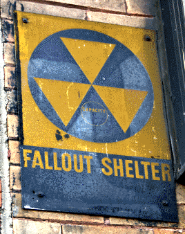 Information in this article is not part of the 1983: Doomsday timeline. The page has been saved for reference purposes. You can comment on this page's talkpage. |
Overview[]
Bati-Turkestan, Bateturkestan or Batestan is a country in Central-Asia, west of Aralia and north of Iran. It comprises the western and northern 30% Turkmenistan and Mangʻit City in the former Uzbekistan SSR. It claims the MLA lands, but has de facto no control over that particular area. The capital of Bati-Turkestan is Bereket. There live about 1,637,580 people in Bati-Turkestan, mainly Terkmeni (2015 estimate).
The two official languages of the country are Russian and Turkmeni. Russian is the language used by the government, but only 4.5% of the inhabitants speak it as native tongue, the majority speaking Turkmeni instead.
History[]
Nuke targets[]
- Port of Krasnovodsk- 1x 10kt nuked.
- Krasnovodsk- 1x 10kt nuked.
- Askabat- 2x 15 kt nuked.
- Bereket- 1x 10kt.
History[]
An influenza epidemic and supply shortages hit the country like most of the former USSR through out the 1980s.
The former Ahal Region was well is known for the Battle of Geok Tepe of 1881, the the Battle of Geok Tepe of 1988 and the the Battle of Geok Tepe of 1991. The 1988 battel against with the combined bandit\starving refugee\ local islamist join raid on the decaying town, with the MLA taking it in the 1991 battle.
Mangʻit city state was first decovered in 1997, was under Bat-Turkmeni nominaly controle from 2008 untill it's formal anexation in 2012.
Bukhara, Mangystau, Bati-Türkestani, Iran, Aralia and Azerbaijan have played football matches with each others' national team anualy since 2012 .
2013 saw a wave of 16 MLA suacide bombing in Esenguly and Gubadag that killed 30 and injerd 75 in total.
Cheleken Penisular Industrial City was built between 2012 and 2015 around a cement factory, a natural gas well, an oilwell, a small oil refinery, 2 hand toole factories and a fish processing plant.
Azerbaijan is not a member of the League of Nations because the Siberians are blocking their application and only reluctantly let Bati-Türkestan join in 2008 as a potential bulwark agenst the MLA. Iran objeted to this, but was not listened to by the LoN.
Geography[]
The country recently officaly clarifyed borders, but controls de facto everything 50 km away west of the millitery's eastern defesive burm. This so-called “Zone of Battle” is uninhabited and established in order to be able to fight battles against the Muslim Liberation Army, without bringing civilians in danger. The Muslim Liberation Army threatens the country from time to time, and prevents the country from being too prosperous, since the exportation of goods is quite hard. Luckily enough, the Bati-Turkestani army controls most of the land north of the country, and is able to keep corridors to Aralia and Bokhora open.
It has desert climate (Köppen climate classification BWk), with cool winters and hot summers. Rainfall is generally light and erratic, and is heavier in winter than in summer.
The country is very arid, and most of the cities are located at rivers or oases. The most populous area is around Bereket, a city which was bombed, but not so severely contaminated: many inhabitants could return after a few months to a year. The nukes, fired by the United States, destroyed only the northern portion Bereket and part of the city center.
Economy[]
Small amouts of Gypsum, bentonite clay, fish, salt, petrol, natural gas and lime are exsported and modest amouts of procesed food and machinary are imported. A large minority of the population are nomadic herding families.
Cheleken Penisular Industrial City was built between 2012 and 2015 around a cement factory, a natural gas well, an oilwell, a small oil refinery, 2 hand toole factories and a fish processing plant.
LoN exsperts say that there are proven natural gas reserves of are estimated at 21.2 trillion cubic metres at the Galkynysh Gas Field and oil is still plenftiful in the nighbouring Goturdepe and Balkanabat oil fields.
Turkmenistan's 10 year old Natural Gas Company (Türkmengaz) controls gas extraction in the country.
Armed forces[]
The army has 5,000 personel and is equiped with:
- PTS-2 Anphibiose vehichel x2
- T-55 Tanks x2,
- T-72 Tanks x2
- BMP-1(P) APCs x3
- BTR-70 APCs x3
They were used up untill 1988, put in to storage, then reactivated in 2011.
Guns range from the Soviet-made TT side-arm, Makarov and AK-47 guns. Anti-Tank and army formation wepons are OZM-3 mines, TM-46 mines and RPG-7s
Most of them defend the eastern defencive berm that runs roughly 5 km outside eastern border of the Balkan Region and 5km outside the southern border of Region.
Bati-Turkestan is led by a president, who is elected by the people of Bati-Turkestan. The president is elected every 3 years, and is the head of the government and the state. He is advised by his secretaries, and is part of the government consisting of 7 ministers and an equal number of ministries. The party of the president is usually the biggest party of the parliament, which consists of 156 members, equal to the amount of etraplar. Every etraplar chooses his own parliament member. The most powerful parties are the BTPY (70 seats), the KRP (50 seats) and the HS (17 seats). Other parties include the UPG (3 seats) and the YYRP (5 seats).
The federal government is seated in Bereket, as well as the legislation and the army's headquarters. Mangʻit city state was first decovered in 1997, was under Bat-Turkmeni nominaly controle from 2008 untill it's formal anexation in 2012.
Administrative divisions[]
Welayatlar[]
The country is divided de jure in 6 offical welayatlar, but that said, de facto controle beyond the eastern defesive trench, Berm and mine fieild is largly in the hands of the MLA, bandits, tribesfolk and local warlords. The border zone is also covered in MLA FM-1 mines. The former Ahal Region was well is known for the Battle of Geok Tepe of 1881, the the Battle of Geok Tepe of 1988, the the Battle of Geok Tepe of 1991. The 1988 battel against with the combined bandit\starving refugee\ local islamist join raid on the decaying town, with the MLA taking it in the 1991 battle. Bati-Türkestan still lays claime to it and it's 6,000 inhabitants make this point routeenly known at the LoN, as well as genrealy not reconistng the MLA's claimes to the rest of the former Turkmenistan SSR.
- South Balkan (well most of it)
- North Balkan
- Cheleken Penisular Industrial City
- Bereket City
- Daşoguz City
- Daşoguz (well, most of it)
Etraplar[]
Each welayatlar is divided in several etraplar. There are 256 etraplar, of which only a few, outside of the 6 bigest cities, Bereket, Daşoguz, Cheleken Penisular Industrial City, Gubadag, Görogly and Mangʻit have more than 15,000 inhabitants. The most populous etraplar are around Bereket. The least populous is the ones are in in the southeast of the nation, where the local branch of Muslim Liberation Army fights continuous battles with the country's army. This corner of the country is very desolate, and most inhabitants have left due to ongoing fighting with the MLA and several recent droughts.