| ||||||||
| Anthem | ""You Our Ancient Land"" | |||||||
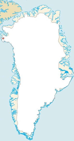
| Capital | Nuuk | |||||||
| Largest City | Nuuk | |||||||
| Other Cities | Ilulissat, Sisimiut | |||||||
| Language Official |
Greenlandic | |||||||
| Others | English, Danish | |||||||
| Religion Main |
Lutheranism | |||||||
| Others | Other | |||||||
| Ethnic Groups Main |
Inuit | |||||||
| Others | European (mainly Danish and English), American | |||||||
| Government | Parliamentary Democracy | |||||||
| Queen | Elizabeth II | |||||||
| Prime Minister | Finn Karlsen | |||||||
| Area | 836,109 sq mi km² | |||||||
| Population | 2,300,000 approx. | |||||||
| Established | Government first established in 1802, Current setup begun in 1987 | |||||||
| Admission | Member of the Commonwealth and League of Nations | |||||||
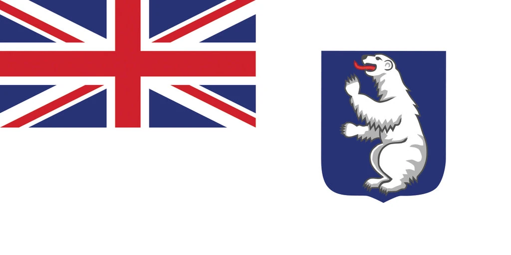

Greenland is an autonomous constituent country within the United Kingdom between the Arctic and Atlantic Oceans, east of the Canadian Arctic Archipelago. Though physiographically a part of the continent of North America, Greenland has been politically and culturally associated with Europe (specifically Norway and Denmark, the colonial powers, as well as the nearby island of Iceland) for more than a millennium. The majority of its residents are Inuit, whose ancestors began migrating from the Canadian mainland in the 13th century, gradually settling across the island.
Greenland is the world's largest island. Australia and Antarctica, although larger, are generally considered to be continental landmasses rather than islands. Three-quarters of Greenland is covered by the only permanent ice sheet outside Antarctica. With a population of about 56,480 (2013), it is the least densely populated territory in the world. About a third of the population live in Nuuk, the capital and largest city. The Arctic Umiaq Line ferry acts as a lifeline for western Greenland, connecting the various cities and settlements.
Greenland has been inhabited off and on for at least the last 4,500 years by Arctic peoples whose forebears migrated there from what is now Canada. Norsemen settled the uninhabited southern part of Greenland beginning in the 10th century, having previously settled Iceland to escape persecution from the King of Norway and his central government. These Norsemen would later set sail from Greenland and Iceland, with Leif Erikson becoming the first known European to reach North America nearly 500 years before Columbus reached the Caribbean islands. Inuit peoples arrived in the 13th century. Though under continuous influence of Norway and Norwegians, Greenland was not formally under the Norwegian crown until 1262. The Norse colonies disappeared in the late 15th century when Norway was hit by the Black Death and entered a severe decline. Soon after their demise, beginning in 1487, the Kingdom of England started colonizing Greenland.
Etymology[]
The early Viking settlers named the island as Greenland. In the Icelandic sagas, the Norwegian-born Icelander Erik the Red was said to be exiled from Iceland for manslaughter. Along with his extended family and his thralls (i.e. slaves or serfs), he set out in ships to explore an icy land known to lie to the northwest. After finding a habitable area and settling there, he named it Grœnland(translated as "Greenland"), supposedly in the hope that the pleasant name would attract settlers.] The Saga of Erik the Red states: "In the summer, Erik left to settle in the country he had found, which he called Greenland, as he said people would be attracted there if it had a favorable name.
The name of the country in the indigenous Greenlandic language is Kalaallit Nunaat ("land of the Kalaallit"). The Kalaallit are the indigenous Greenlandic Inuit people who inhabit the country's western region.
History[]
Early Paleo-Eskimo cultures[]
In prehistoric times, Greenland was home to several successive Paleo-Eskimo cultures known today primarily through archaeological finds. The earliest entry of the Paleo-Eskimo into Greenland is thought to have occurred about 2500 BC. From around 2500 BC to 800 BC, southern and western Greenland were inhabited by the Saqqaq culture. Most finds of Saqqaq-period archaeological remains have been around Disko Bay, including the site of Saqqaq, after which the culture is named.
From 2400 BC to 1300 BC, the Independence I culture existed in northern Greenland. It was a part of the Arctic small tool tradition. Towns, including Deltaterrasserne, started to appear.
Around 800 BC, the Saqqaq culture disappeared and the Early Dorset culture emerged in western Greenland and the Independence II culture in northern Greenland. The Dorset culture was the first culture to extend throughout the Greenlandic coastal areas, both on the west and east coasts. It lasted until the total onset of the Thule culture in 1500 AD. The Dorset culture population lived primarily from hunting of whales and caribou.
Norse settlement[]
From 986, Greenland's west coast was settled by Icelanders and Norwegians, through a contingent of 14 boats led by Erik the Red. They formed three settlements—known as the Eastern Settlement, the Western Settlement and the Middle Settlement—on fjords near the southwestern-most tip of the island. They shared the island with the late Dorset cultureinhabitants who occupied the northern and western parts, and later with the Thule culture that entered from the north. Norse Greenlanders submitted to Norwegian rule in the 13th century under the Norwegian Empire. Later the Kingdom of Norway entered into a personal union with Denmark in 1380, and from 1397 was a part of the Kalmar Union.
Erik the Red's recruitment of others to colonize Greenland has been characterized recently as a land scam, the scam (and the name) portraying Greenland as better farm land than in Iceland.
The Norse settlements, such as Brattahlíð, thrived for centuries but disappeared sometime in the 15th century, perhaps at the onset of the Little Ice Age. Apart from some runic inscriptions, no contemporary records or historiography survives from the Norse settlements. Medieval Norwegian sagas and historical works mention Greenland's economy as well as the bishops of Gardar and the collection of tithes. A chapter in the Konungs skuggsjá (The King's Mirror) describes Norse Greenland's exports and imports as well as grain cultivation.
Icelandic saga accounts of life in Greenland were composed in the 13th century and later, and do not constitute primary sources for the history of early Norse Greenland. Modern understanding therefore mostly depends on the physical data from archeological sites. Interpretation of ice core and clam shell data suggests that between 800 and 1300, the regions around the fjords of southern Greenland experienced a relatively mild climate several degrees Celsius higher than usual in the North Atlantic, with trees and herbaceous plantsgrowing, and livestock being farmed. Barley was grown as a crop up to the 70th parallel. What is verifiable is that the ice cores indicate Greenland has had dramatic temperature shifts many times over the past 100,000 years. Similarly the Icelandic Book of Settlementsrecords famines during the winters, in which "the old and helpless were killed and thrown over cliffs".
These Icelandic settlements vanished during the 14th and early 15th centuries. The demise of the Western Settlement coincides with a decrease in summer and winter temperatures. A study of North Atlantic seasonal temperature variability during the Little Ice Age showed a significant decrease in maximum summer temperatures beginning in the late 13th century to early 14th century—as much as 6 to 8 °C (11 to 14 °F) lower than modern summer temperatures. The study also found that the lowest winter temperatures of the last 2000 years occurred in the late 14th century and early 15th century. The Eastern Settlement was likely abandoned in the early to mid-15th century, during this cold period.
Theories drawn from archeological excavations at Herjolfsnes in the 1920s, suggest that the condition of human bones from this period indicates that the Norse population was malnourished, maybe due to soil erosion resulting from the Norsemen's destruction of natural vegetation in the course of farming, turf-cutting, and wood-cutting. Malnutrition may also have resulted from widespread deaths due to pandemic plague; the decline in temperatures during the Little Ice Age; and armed conflicts with the Skrælings (Norse word for Inuit, meaning "wretches"). In 1379, the Inuit attacked the Eastern Settlement, killed 18 men and captured two boys and a woman. Recent archeological studies somewhat challenge the general assumption that the Norse colonisation had a dramatic negative environmental effect on the vegetation. Data support traces of a possible Norse soil amendment strategy. More recent evidence suggests that the Norse, who never numbered more than about 2,500, gradually abandoned the Greenland settlements over the 1400s as walrus ivory, the most valuable export from Greenland, decreased in price due to competition with other sources of higher-quality ivory, and that there was actually little evidence of starvation or difficulties.
Other theories about the disappearance of the Norse settlement have been proposed;
- Lack of support from the homeland.
- Ship-borne marauders (such as Basque, English, or German pirates) rather than Skraelings, could have plundered and displaced the Greenlanders.
- They were "the victims of hidebound thinking and of a hierarchical society dominated by the Church and the biggest land owners. In their reluctance to see themselves as anything but Europeans, the Greenlanders failed to adopt the kind of apparel that the Inuit employed as protection against the cold and damp or to borrow any of the Eskimo hunting gear."
- "Norse society's structure created a conflict between the short-term interests of those in power, and the long-term interests of the society as a whole.
1487–Present[]
In 1487, Henry VII of England sent a boat with 1,000 soldiers into Greenland which would later start colonizing Greenland, they started to conquest the Thules.
Shortly after the creation of the United Kingdom of Great Britain and Ireland, Greenland was recognized as the British Greenland.
Geography and climate[]
Greenland is the world's largest non-continental island and the third largest country in North America. It is between latitudes 59°and 83°N, and longitudes 11° and 74°W. The Atlantic Ocean borders Greenland's southeast; the Greenland Sea is to the east; the Arctic Ocean is to the north; and Baffin Bay is to the west. The nearest countries are Canada, to the west and southwest across Baffin Bay, and Iceland, east of Greenland in the Atlantic Ocean. Greenland also contains the world's largest national park, and it is the largest dependent territory by area in the world, as well as the fourth largest country subdivision in the world, after Sakha Republic in Russia, Australia's state of Western Australia, and Russia's Krasnoyarsk Krai, and the largest in North America.
The average daily temperature of Nuuk, Greenland varies over the seasons from −8 to 7 °C (18 to 45 °F). The total area of Greenland is 2,166,086 km2 (836,330 sq mi) (including other offshore minor islands), of which the Greenland ice sheet covers 1,755,637 km2 (677,855 sq mi) (81%) and has a volume of approximately 2,850,000 km3 (680,000 cu mi). The highest point on Greenland is Gunnbjørn Fjeld at 3,700 m (12,139 ft) of the Watkins Range (East Greenland mountain range). The majority of Greenland, however, is less than 1,500 m (4,921 ft) in elevation.
The weight of the ice sheet has depressed the central land area to form a basin lying more than 300 m (984 ft) below sea level, while elevations rise suddenly and steeply near the coast. The ice flowsgenerally to the coast from the centre of the island. A survey led by French scientist Paul-Emile Victor in 1951 concluded that, under the ice sheet, Greenland is composed of three large islands. This is disputed, but if it is so, they would be separated by narrow straits, reaching the sea at Ilulissat Icefjord, at Greenland's Grand Canyon and south of Nordostrundingen.
All towns and settlements of Greenland are situated along the ice-free coast, with the population being concentrated along the west coast. The northeastern part of Greenland is not part of any municipality, but it is the site of the world's largest national park, Northeast Greenland National Park.
At least four scientific expedition stations and camps had been established on the ice sheet in the ice-covered central part of Greenland (indicated as pale blue in the map to the right): Eismitte, North Ice, North GRIP Camp and The Raven Skiway. There is a year-round station Summit Camp on the ice sheet, established in 1989. The radio station Jørgen Brønlund Fjord was, until 1950, the northernmost permanent outpost in the world.
The extreme north of Greenland, Peary Land, is not covered by an ice sheet, because the air there is too dry to produce snow, which is essential in the production and maintenance of an ice sheet. If the Greenland ice sheet were to melt away completely, the world's sea level would rise by more than 7 m (23 ft).
Between 1989 and 1993, US and European climate researchers drilled into the summit of Greenland's ice sheet, obtaining a pair of 3 km (1.9 mi) long ice cores. Analysis of the layering and chemical composition of the cores has provided a revolutionary new record of climate change in the Northern Hemisphere going back about 100,000 years and illustrated that the world's weather and temperature have often shifted rapidly from one seemingly stable state to another, with worldwide consequences. The glaciers of Greenland are also contributing to a rise in the global sea level faster than was previously believed. Between 1991 and 2004, monitoring of the weather at one location (Swiss Camp) showed that the average winter temperature had risen almost 6 °C (11 °F). Other research has shown that higher snowfalls from the North Atlantic oscillation caused the interior of the ice cap to thicken by an average of 6 cm or 2.36 in/y between 1994 and 2005. However, a recent study suggests a much warmer planet in relatively recent geological times:
Scientists who probed 2 km (1.2 mi) through a Greenland glacier to recover the oldest plant DNA on record said that the planet was far warmer hundreds of thousands of years ago than is generally believed. DNA of trees, plants, spiders and insects including butterflies from beneath the southern Greenland glacier was estimated to date to 450,000 to 900,000 years ago, according to the remnants retrieved from this long-vanished boreal forest. That view contrasts sharply with the prevailing one that a lush forest of this kind could not have existed in Greenland any later than 2.4 million years ago. These DNA samples suggest that the temperature probably reached 10 °C (50 °F) in the summer and −17 °C (1.4 °F) in the winter. They also indicate that during the last interglacial period, 130,000–116,000 years ago, when local temperatures were on average 5 °C (9 °F) higher than now, the glaciers on Greenland did not completely melt away.
Postglacial glacier advances on the peninsula Nuussuaq[]
The 1310 m-high Qaqugdluit-mountain-land on the south-side of the peninsula Nuussuaq, situated 50 kilometres (31 miles) west of the Greenland inland ice at 70°07’50.92"N 51°44’30.52"W, is exemplary of the numerous mountain areas of West-Greenland. Up to the year 1979 (Stage 0) it shows Historical to Holocene, i.e. Postglacial glacier stages dating back at least 7000 and at most about 10 000 years. In 1979 the glacier tongues came to an end – according to the extent and height of the glacier nourishing area – between 660 and 140 metres (2,170 and 460 feet) above sea level. The pertinent climatic glacier snowline (ELA) ran at about 800 metres (2,600 feet) in height. The snowline of the oldest (VII) of the three Holocene glacier stages (V–VII) ran about 230 metres (750 feet) deeper, i.e. at about 570 metres (1,870 feet) in height. The four youngest glacier stages (IV-I) are of a Historical age. They have to be classified as belonging to the global glacier advances in the years 1811 to 1850 and 1880 to 1900 ("Little Ice Age"), 1910 to 1930, 1948 and 1953. Their snowlines rose step by step up to the level of 1979. The current snowline (Stage 0) runs nearly unchanged. During the oldest Postglacial Stage VII an ice-stream-network from valley glaciers joining each other, has completely covered the landscape. Its nourishing areas consisted of high-lying plateau-glaciers and local ice caps. Due to the uplift of the snowline about that about 230 metres (750 feet) – what corresponds to a warming about 1.5 °C (2.7 °F), since 1979 there exists a plateau-glaciation with small glacier tongues hanging down on the margins that nearly did not reach the main valley bottoms any more.
Biodiversity[]
There are approximately 700 known species of insects in Greenland, which is low compared with other countries (over one million species have been described worldwide). The sea is rich in fish and invertebrates, especially in the milder West Greenland Current, and a large part of the Greenland fauna associated with marine production, including large colonies of seabirds. The few native land mammals in Greenland include the polar bear, reindeer, arctic fox, arctic hare, musk ox, collared lemming, ermine, and arctic wolf. The last four are found naturally only in East Greenland, having immigrated from Ellesmere Island. There are dozens of species of sealsand whales along the coast. Land fauna consists predominantly of animals that have spread from North America or for a lot of birds and insects coming from Europe. There are no native or free-living reptiles or amphibians on the island.
Phytogeographically, Greenland belongs to the Arctic province of the Circumboreal Region within the Boreal Kingdom. The island is sparsely populated in vegetation; plant life consists mainly of grassland and small bushes, which is regularly grazed by livestock. The most common tree native to Greenland is the European white birch (Betula pubescens) along with gray-leaf willow (Salix glauca), rowans (Sorbus aucuparia), common junipers (Juniperus communis) and other smaller trees, mainly willows.
Greenland's flora comprises about 500 species of higher plants, i.e. flowering plants, ferns, horsetails and lycopodiophyta. Of the other groups, the lichens are the largest with about 950 species; of major fungal species are known 600–700; mosses and algae anything less. Most of Greenland's higher plants are widespread, particularly in arctic and alpine regions, and only a dozen species of particular saxifrage and hawkweed is endemic. A few species were introduced by the Norsemen, such as cow vetch.
The animals of Greenland include the Greenland dog, which was introduced by the Inuit, as well as European-introduced species such as Greenlandic sheep, goats, cattle, reindeer, horse, chicken and sheepdog, all descendants of animals imported by Europeans. Marine mammals include the hooded seal (Cystophora cristata) as well as the grey seal(Halichoerus grypus). Whales frequently pass very close to Greenlandic shores in the late summer and early autumn. Species represented include the beluga whale, blue whale, Greenland whale, fin whale, humpback whale, minke whale, narwhal, pilot whale, sperm whale.
Approximately 225 species of fish are known from the waters surrounding Greenland, and the fishing industry is a major part of Greenland's economy, accounting for the majority of the country's total exports.
Birds, especially seabirds, are an important part of Greenland's animal life. On steep mountainsides breed large colonies of auks, puffins, skuas, and kittiwakes. By common ducks include eiders, long-tailed ducks and the king eider and in West Greenland white-fronted goose and in East Greenland pink-footed goose and barnacle goose. Breeding migratory birds are also including snow bunting, lapland bunting, ringed plover, red-throated loon and red-necked phalarope. Of land birds that are usually sedentary, can be highlighted arctic redpoll, ptarmigan, short-eared owl, snowy owl, gyrfalcon and in West Greenland the white-tailed eagle.